Channel Markers: Understanding the Signs
Navigating open water is both exhilarating and, at times, deceptively complex. While modern GPS systems and chartplotters provide incredible assistance, there is still no substitute for understanding the physical navigation system around you, especially channel markers. These markers are the silent guides of the waterways, helping boaters stay safe, avoid hazards, and travel efficiently from one point to another.
Whether you’re cruising along the Intracoastal, heading offshore, or exploring inland waterways, knowing how to read channel markers is a fundamental skill every boater should master. For beginners, they may appear confusing - a mix of colors, shapes, and numbers. But once you understand their logic, they become an intuitive language that tells you exactly where you are and where you should go.
This guide breaks down everything you need to know—from the purpose behind channel markers to the nuances that experienced boaters rely on every day.
What is the Purpose of Channel Markers?
Channel markers exist to create safe, navigable pathways through waterways that might otherwise be difficult - or dangerous - to pass through. Natural bodies of water are rarely uniform. Depths change, sandbars shift, underwater obstructions appear, and currents can alter safe routes over time.
Channel markers serve several essential purposes:
Define Safe Navigation Channels
Markers outline the deepest and safest route through a body of water, particularly in areas where hazards like shoals, rocks, or reefs exist. Staying within these boundaries significantly reduces the risk of running aground.
Provide Directional Guidance
They indicate which side of the channel you should be on depending on your direction of travel. This is especially critical in narrow or high-traffic waterways.
Communicate Hazards
Certain markers warn of dangers such as submerged objects, restricted areas, or sudden changes in water depth.
Assist in Navigation Without Electronics
Even in an age of digital navigation, markers remain vital. Electronics can fail, signals can drop, and charts can become outdated - but physical markers are always there as a reliable reference.
Regulate Traffic and Behavior
Some markers indicate speed zones, no-wake areas, or restricted zones, helping maintain safety for all water users.
In short, channel markers are the marine equivalent of road signs, lane markers, and traffic signals - all combined into one system. The key difference is that, on the water, there are no painted lines or guardrails to rely on - only these markers. Boaters must be more actively engaged, constantly reading and interpreting their surroundings rather than passively following a fixed path. Understanding channel markers doesn’t just help you navigate - it transforms the open water into a readable, structured system, much like a well-marked roadway.

Shapes and Variations of Channel Markers & Buoys
Channel markers come in several forms, each designed to convey information quickly and clearly—even from a distance. Understanding both shape and color is key to interpreting their meaning correctly.
Lateral Markers
Lateral markers are the most common type you’ll encounter. They define the sides of a navigable channel and are used together to create a “path” for boats to follow. They rely on a simple but crucial concept:
When returning from open water (heading inland), red markers stay on your right (starboard), and green markers stay on your left (port).
This is often remembered with the phrase: “Red, Right, Returning.”
Lighted Buoys
Lighted buoys are equipped with lights to make them visible at night or in low-visibility conditions such as fog or heavy rain. Each light has a specific pattern—flashing, quick flashing, or alternating—that corresponds to its type. These patterns help boaters identify markers even when color is hard to distinguish.
Key advantages:
- Increased visibility at night – Lighted buoys make navigation possible in low-light conditions, helping boaters maintain their course safely even after sunset or in reduced visibility.
- Identification from long distances – Their illumination allows boaters to spot markers well in advance, giving more time to adjust speed or direction as needed.
- Reinforcement of marker type through light rhythm – Unique flashing patterns provide an additional layer of identification, allowing mariners to confirm a marker’s meaning even when color or shape is difficult to distinguish.
Daymarks
Daymarks are fixed markers mounted on posts or pilings rather than floating in the water. They are commonly found in shallow areas or along narrow channels. They typically display:
- A colored geometric shape (square or triangle)
- Numbers or letters for identification
Because they are stationary, daymarks are especially reliable in areas where buoys might drift due to currents or storms.
Can Buoys
Can buoys are cylindrical in shape with flat tops. They are always green and mark the left side of the channel when returning inland. They are specifically designed to be easily distinguishable especially in choppy water.
Characteristics:
- Flat-topped appearance
- Even-numbered labeling
- Green coloring
Nun Buoys
Nun buoys have a conical (pointed) top and are always red. They mark the right side of the channel when returning inland. Their distinct shape helps boaters quickly differentiate them from can buoys, even at a distance.
Characteristics:
- Cone-shaped top
- Odd-numbered labeling
- Red coloring

Types of Markers
Beyond basic shapes and buoy types, markers are categorized based on their function. Each type provides specific information about navigation, safety, or restrictions.
Lateral Markers
Lateral markers are the backbone of the navigation system. They define the edges of channels and guide vessels safely through them. They come in both buoy and daymark forms and rely on consistent color and numbering systems to communicate direction.
Non-Lateral Markers
Non-lateral markers provide information unrelated to channel edges. Instead, they communicate warnings, restrictions, or guidance. They are typically white with colored symbols and shapes.
Colors & Numbers
Color and numbering are essential to interpreting lateral markers correctly. These markers are especially important when navigating unfamiliar waters, as they guide you through branching routes.
Green markers indicate the left (port) side of the channel when returning inland.
- Typically even-numbered
- Often paired with can buoys or square daymarks
- Numbers increase as you move inland
Red markers indicate the right (starboard) side of the channel when returning inland.
- Typically odd-numbered
- Often paired with nun buoys or triangular daymarks
- Numbers increase as you move inland
Markers featuring both red and green indicate a junction or split in the channel. The color on top tells you the preferred (primary) channel:
- Red on top → treat it as a red marker
- Green on top → treat it as a green marker
Directional & Informational Markers
These markers provide general guidance that helps boaters make informed decisions while navigating unfamiliar or busy waterways. Unlike regulatory or hazard markers, their purpose is not to warn or restrict, but to assist—offering helpful details that enhance situational awareness and trip planning.
They commonly include information such as:
- Directions to marinas, fuel docks, boat ramps, or other points of interest
- Distances to nearby destinations or key navigation points
- Navigational advice, such as recommended routes or channel guidance
They are especially valuable for transient boaters or those exploring new areas, where local knowledge may be limited. While they may not indicate immediate hazards, they should still be noted carefully, as they often point toward essential services or help confirm you’re on the correct course.
Directional and informational markers are typically rectangular in shape, featuring orange symbols or lettering on a white background for high visibility.
Controlled Area Markers
Controlled area markers are crucial for maintaining safety in high-traffic or sensitive areas like marinas and residential waterfronts. They indicate zones where specific rules apply, such as:
- No wake
- Idle speed
- Speed limits
Hazardous & Obstructed Waterway Warnings
These warning markers are designed to alert boaters to potential risks that may not be immediately visible from the surface, and require extra caution when navigating nearby. They are especially important as these types of hazards can shift over time due to tides, currents, or ongoing work. These markers warn of dangers such as:
- Rocks
- Shoals
- Construction zones
- Submerged debris
They often feature orange diamonds and should be taken seriously - ignoring them can result in damage or grounding. Boaters should reduce speed, maintain a careful lookout, and give these areas a wide berth whenever possible to avoid damage or grounding.
Forbidden Area Markers
Marked with an orange circle and slash, these indicate areas where boating is not allowed. These markers are intended to clearly define boundaries that protect people, property, and sensitive environments, and should always be respected regardless of water conditions or traffic levels.
Common examples include:
- Swimming zones
- Environmental protection areas
- Military or restricted zones
Entering these areas can result in fines or dangerous situations, including risks to swimmers, damage to fragile ecosystems, or potential security concerns. Boaters should remain alert for these markers and adjust their course early to ensure they stay well outside restricted boundaries.
Obstruction Markers – Inland Waters
These markers indicate specific hazards that exist below the surface, alerting boaters to dangers that may not be visible but could pose a serious risk to hulls, propellers, or navigation. They are often black-and-white vertically striped and can signal:
- There is an obstruction beneath the water
- Safe passage may exist on either side
Because these hazards can vary in size and depth, boaters should not assume uniform clearance around the marker. It’s best to slow down, maintain a careful lookout, and give the area extra space whenever possible. Boaters should proceed with caution and reduced speed when near these markers, especially in unfamiliar waters where the exact nature of the obstruction may not be immediately clear.
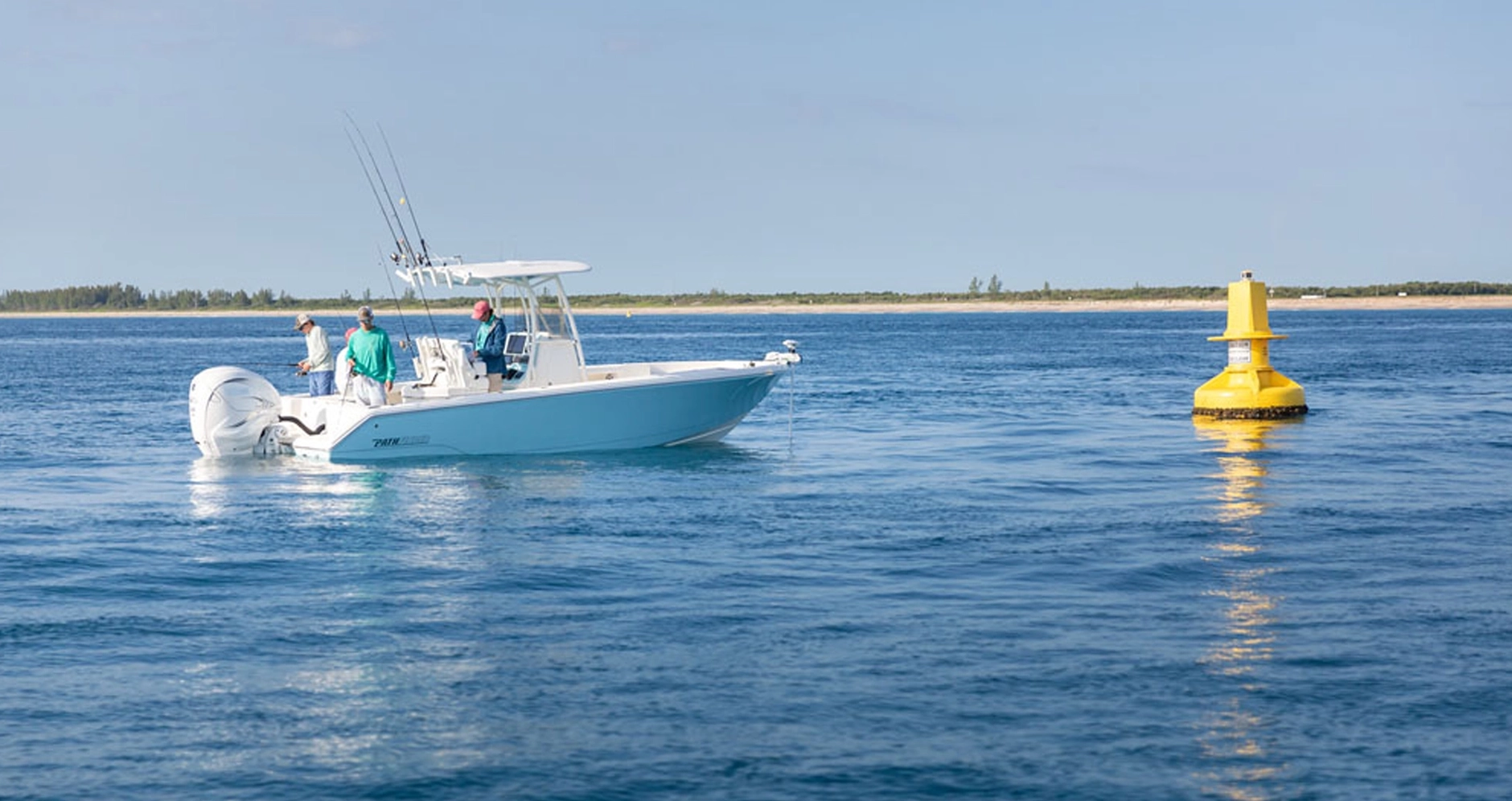
Safe Water Markers
Safe water markers indicate that navigable water exists all around the marker, signaling that it is safe to pass on any side. They are often used to confirm you are in open, unobstructed water and can serve as reliable reference points when entering or approaching a channel.
They are typically:
- Red and white vertical stripes – making them highly visible and easily distinguishable from other marker types
- Used to mark mid-channels or landfalls – helping boaters identify safe passage routes and the center of navigable waterways
They are especially helpful when approaching from open water, guiding vessels toward safe entry points. In many cases, they act as a visual reassurance that you are aligned with a proper channel, particularly in areas where other lateral markers may not yet be visible.
Mooring Buoys
Mooring buoys are used to secure boats rather than guide navigation. Boaters can tie off to these buoys instead of anchoring, which is especially useful in protected or environmentally sensitive areas where dropping an anchor could damage seagrass, coral, or underwater habitats.
They also provide a convenient and often more secure option in locations where anchoring space is limited or conditions make anchoring difficult. They are usually white with a blue horizontal band and are typically maintained by marinas, parks, or local authorities, so it’s always a good idea to confirm whether permission or a fee is required before use.
Remembering The Information
At first, the system of channel markers may feel overwhelming, but a few simple memory tools make it much easier:
- “Red, Right, Returning” → Keep red markers on your right when heading inland
- Think of red as stop/right (like brake lights or stop signs)
- Green = go/left when returning
- Shapes help confirm color:
- Square = green
- Triangle = red
Repetition is key. The more time you spend on the water actively identifying markers, the more second-nature it becomes.
Many experienced boaters don’t consciously think through each marker - they recognize patterns instantly based on practice.
Exceptions to the Rules
While the navigation system is generally consistent, there are important exceptions that every boater should be aware of.
Intercoastal Waterways
The Intracoastal Waterway (ICW) introduces additional markers to help boaters follow its unique route. These yellow markers override standard lateral rules when following the ICW. This system ensures continuity along the entire waterway, even when it intersects with local channels. Boaters should look for:
- Yellow symbols on markers
- Yellow triangle → stay on the right
- Yellow square → stay on the left
Western River System
In parts of the United States, particularly along inland rivers, the navigation system differs slightly from the standard lateral system most boaters are familiar with. Because of these regional variations, it’s especially important to consult local charts, signage, and guidance before heading out on unfamiliar inland waterways.
On many river systems, markers may not follow the traditional “Red, Right, Returning” rule. Instead, navigation is based on the direction of the river’s current - specifically whether you are traveling upstream or downstream. This means that what is considered the “returning” direction can change depending on the flow of the river, which can be confusing for boaters accustomed to coastal navigation.
Understanding this distinction is key to staying within safe channels and avoiding hazards, particularly in narrow or fast-moving river environments where there is less margin for error.
Final Thoughts
Reading channel markers is one of the most essential skills any boater can develop. While technology has transformed navigation, these physical markers remain the foundation of safe and effective travel on the water.
They do more than just guide you - they communicate. They warn you of danger, direct you through safe paths, and help you understand the water around you in real time.
- For new boaters: the system may seem complex at first. But with a bit of study and time on the water, it quickly becomes intuitive. Each marker you pass reinforces your understanding, building confidence with every trip.
- For experienced boaters: mastering channel markers isn’t just about safety - it’s about precision. It allows you to navigate efficiently, avoid costly mistakes, and operate with a level of awareness that sets you apart.
At the end of the day, boating is about freedom - the freedom to explore, relax, and connect with the water. Understanding channel markers ensures that freedom is backed by knowledge, keeping every journey as safe as it is enjoyable.
